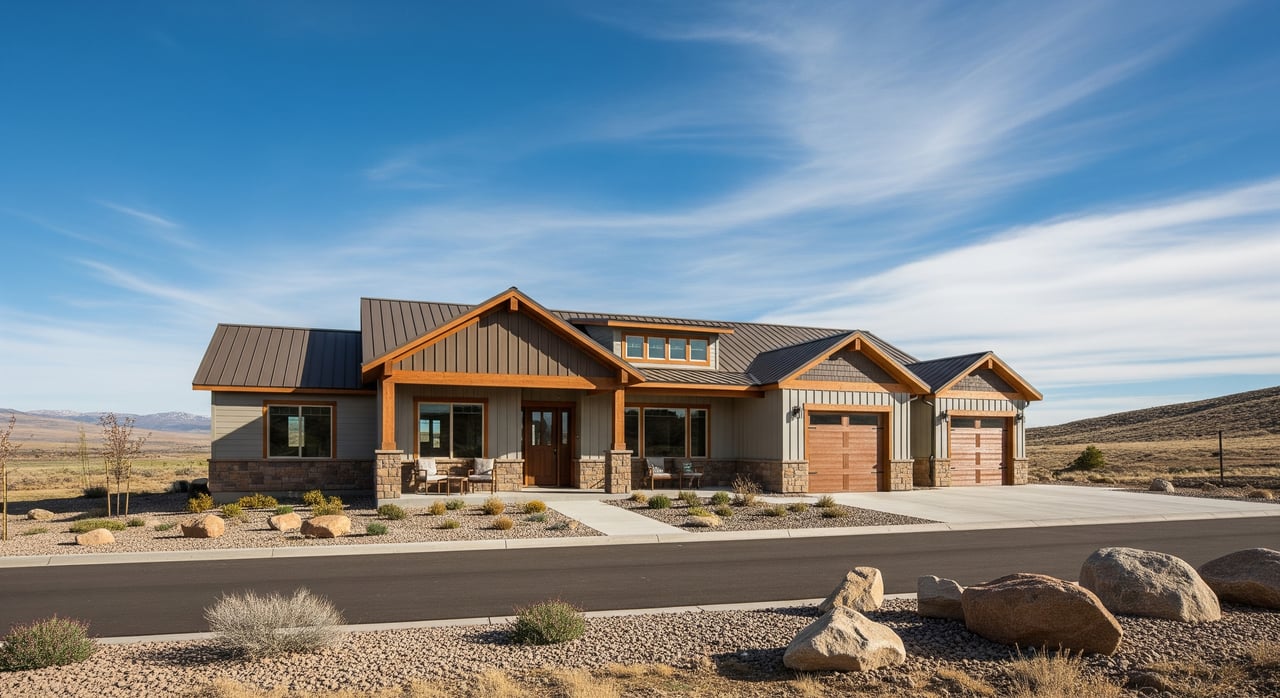
Thinking about building a home with red‑rock views in Leeds? A sloped lot can be a stunning asset, but it comes with extra design choices, permitting steps and site risks. If you plan ahead, you can protect your budget, reduce headaches and create a home that fits the hillside. This guide walks you through local rules, smart design strategies and a clear checklist to move forward with confidence. Let’s dive in.
Leeds slopes at a glance
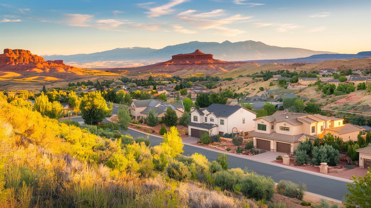
Leeds sits along canyon and mesa terrain where steep slopes and ridgelines are common. The area’s geology includes units that can be susceptible to landslides, rockfall and adverse soils, so site‑specific evaluation is important. The Utah Geological Survey highlights geologic hazards in the broader St. George–Hurricane area that includes Leeds, which is a useful starting point for due diligence. You can also get basic town context from the Leeds profile.
- Review regional geologic hazards for the St. George–Hurricane area: Utah Geological Survey guidance
- Learn about the town and setting: Leeds, Utah overview
Intense, localized storms are part of life in southern Utah. Flash floods and rapid runoff can impact upland sites, not just river bottoms, so drainage design is essential. Recent reporting points to rising flash‑flood frequency in Utah, which reinforces the need to plan for short, heavy rain events.
- Read more on shifting flood patterns: flash floods rising in Utah
Wildfire is another planning factor. Leeds sits near semi‑wildland areas, and local policy encourages defensible space and fire‑sensitive siting in wildland‑urban interface areas.
- See county WUI references: Washington County wildfire guidance
Local rules that shape your design
Washington County and the Town of Leeds regulate how much you can disturb on a slope and what studies you need. The county’s hillside standards flag slope bands and expect steeper areas to remain mostly undisturbed. The Town of Leeds also treats slopes over 20 percent as special and generally prohibits development on slopes 30 percent or greater except by special exception.
- Key thresholds to know:
- 0–19% slopes are typically handled under standard rules.
- 20–29% slopes trigger strong disturbance limits. The county expects about 70% of these areas to stay undisturbed.
- ≥30% slopes face very heavy restrictions and are often unsuitable without a special exception. Leeds generally prohibits building here.
- Read the county hillside standards: Washington County slope rules
- See Leeds land‑use ordinance: Leeds slope provisions
Permitting often requires more than a standard building application for hillside sites. Expect to provide a geotechnical report, grading plans, and documentation for floodplain, septic and wildfire where applicable. It helps to contact the county early and confirm submittal needs.
- Start here for submittals and checklists: Washington County Community Development permits
- Check for mapped flood risk: FEMA Map Service Center
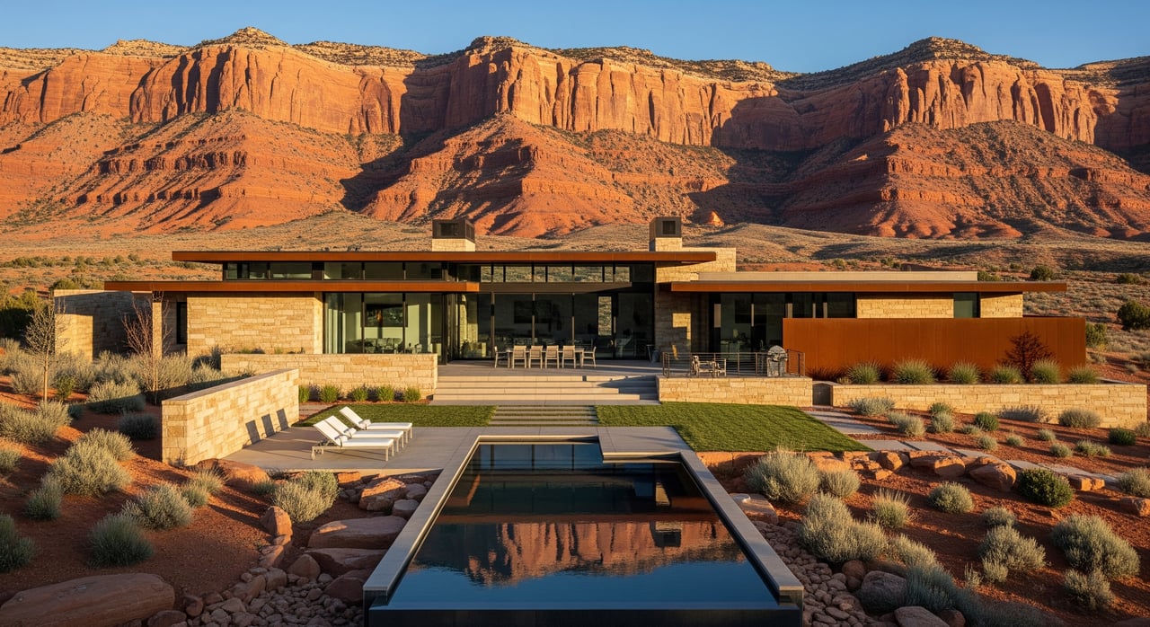
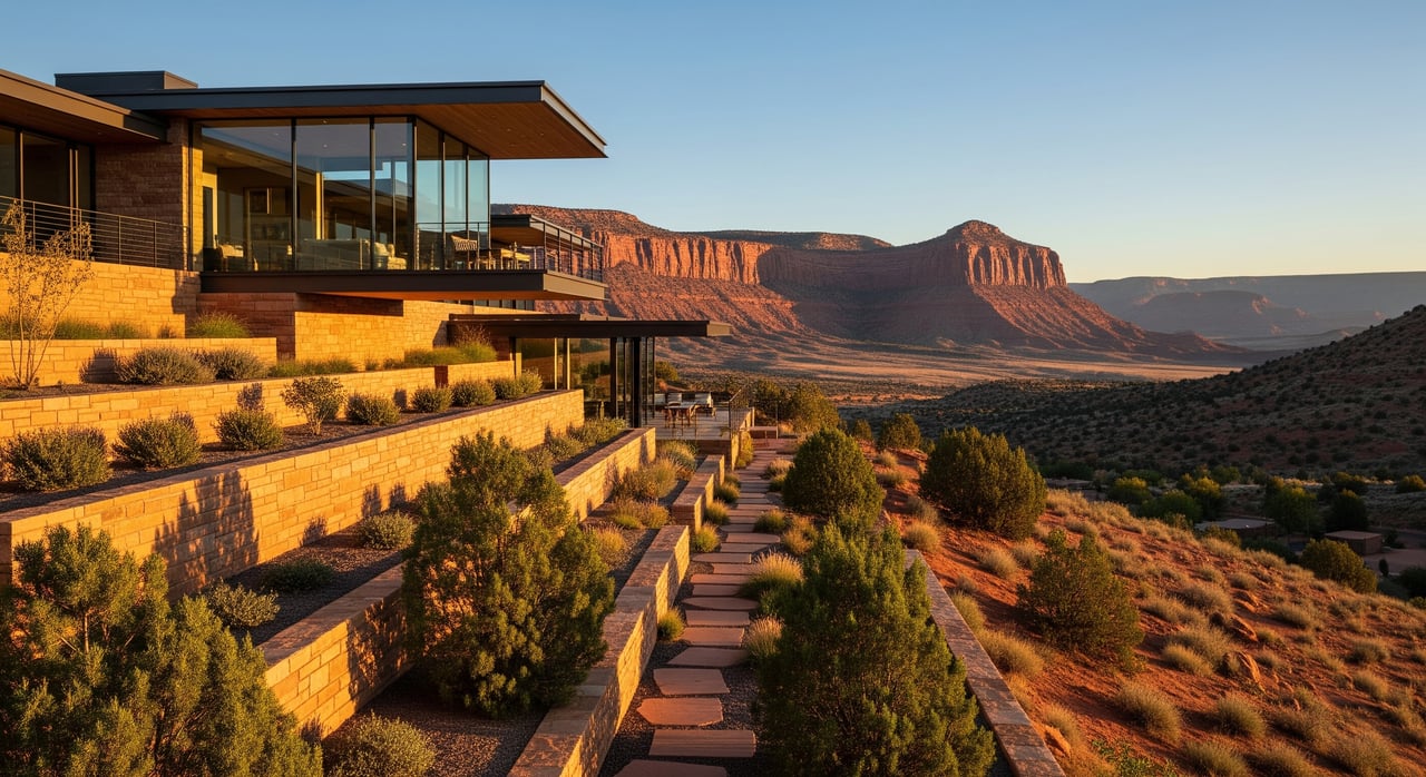
Smart design strategies that work
Start with siting and survey
Your first win is smart placement. Cluster the footprint on the gentlest part of the lot and avoid projecting the roofline on ridges where the county discourages silhouettes. Preserve natural drainages and use bridging for unavoidable crossings.
- County guidance emphasizes minimal grading and contour‑friendly design: design standards and retaining guidance
Get geotechnical insight
On most sloped parcels you should plan for a geotechnical investigation before final design. A qualified engineering geologist or geotechnical engineer will map hazards, recommend foundation types, and outline earthwork and drainage measures. The county commonly conditions approvals on following the report.
Choose foundations that fit
Split‑level or stepped foundations reduce cut and fill while keeping the footprint compact. Where near‑surface soils are weak, your engineer may recommend piers or drilled shafts to control settlement. A daylight basement can work well on moderate slopes if waterproofing and subdrainage are detailed correctly.
Retaining walls done right
Keep cuts and fills low where you can. Large walls, or walls that support structures or change drainage, usually require engineered plans and permits. Always include wall drainage like weep systems and cleanouts to prevent water pressure buildup.
Manage water and erosion
Positive drainage is non‑negotiable. Pitch grades away from the foundation, capture roof runoff, and route water to approved, stabilized outlets. Phase your grading, use erosion‑control BMPs like sediment fences and temporary seeding, and show downstream routing on your site plan to avoid impacts on neighbors.
Landscape for stability and fire safety
Revegetate disturbed areas with native, drought‑tolerant plants to stabilize soils. Terracing with native shrubs and erosion‑control matting helps during the first seasons after construction. Create defensible space and consider fire‑resistant exterior details in WUI areas.
Plan access and utilities early
Steep or long driveways may need engineering for slope, drainage and emergency access. Map septic, wells and stormwater outfalls on the first site plan so you maintain clearances from cuts and retaining systems. Early coordination reduces redesigns and change orders.
Preconstruction checklist
Use this quick list before you finalize plans or make an offer on a sloped lot.
- Confirm mapped flood risk for the parcel using the FEMA Map Service Center.
- Schedule a pre‑application call with Washington County and confirm hillside and WUI overlays. Start with the county permits page.
- Order a topographic survey that shows slope bands, drainages and property lines.
- Engage a licensed geotechnical engineer or engineering geologist to scope the investigation and provide foundation and earthwork recommendations.
- Build your team: civil engineer for grading and drainage, structural engineer for foundations and walls, architect with hillside experience, and a landscape pro for revegetation and defensible space.
- Align your concept with code limits. Plan to leave most 20–29% slope areas undisturbed and avoid ≥30% slopes unless a special exception is feasible. See county hillside standards and Leeds ordinance.
Build confidently in Leeds
A hillside lot in Leeds can deliver views, privacy and smart use of land when you pair the right site with the right plan. By respecting slope thresholds, investing in geotechnical work, and designing drainage and vegetation carefully, you set your project up for success. If you want help vetting lots or coordinating next steps with local pros, reach out to Dallas Curtis for guidance tailored to your goals.
FAQs
Do I need a geotechnical report for a sloped lot in Leeds?
- If your site has notable slope or special conditions, the county commonly requires a geotechnical report with your permits; start with the county checklist.
What slopes are considered buildable in Washington County and Leeds?
- As a rule of thumb, 0–19% slopes are generally buildable, 20–29% slopes have strong disturbance limits, and ≥30% slopes face heavy restrictions or prohibition; see county hillside standards and Leeds ordinance.
How do I check flood risk on a hillside parcel near Leeds?
- Use the FEMA Map Service Center and ask the county floodplain administrator if you have questions; design drainage for intense, short‑duration storms even if you are outside mapped flood zones.
What should I know about retaining walls in Washington County?
- Tall or load‑bearing walls and walls that alter drainage typically need engineered plans, permits and maintenance provisions; see county design and retaining guidance.
How does wildfire risk affect hillside home design in Leeds?
- Plan defensible space and consider fire‑resistant materials in WUI areas; review county references for wildfire guidance.